* Astronomy

| Post Info |
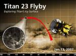
TOPIC: Titan
|
||||||||||
|---|---|---|---|---|---|---|---|---|---|---|---|
|
L

|
|
||||||||||
|
L
|
|
||||||||||
|
L
|
|
||||||||||
|
L
|
|
||||||||||
|
L
|
|
||||||||||
|
L
|
|
||||||||||
|
L
|
|
||||||||||
|
L
|
|
||||||||||
|
L
|
|
||||||||||
|
L
|
|
||||||||||
|
|||||||||||


|
|
||
